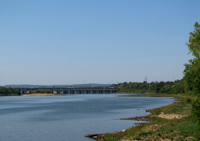
Tulsa is built on a bend in the Arkansas River. The strip of land between Riverside Drive and the east bank of the river has been developed as a River Park. The parks' 26 miles of asphalt-surfaced trails weave past gathering areas, playgrounds, fountains and sculptures along the banks of the river. The river is filled bank to bank in this photo north of the Pedestrian Bridge to the 21st street bridge because water is retained just behind us by a low water dam. The city is proposing to build several additional such retention dams at locations down stream to keep the river filled bank to bank as far south as the bridge to Jenks. As it is now much of the river from the low water dam south is a sand bar most of the time. Interest in developing attractions along the river would be encouraged if there were a stable water line. The funds for this project will come from extending a small sales tax scheduled to be retired later in the year. I think this is an investment in the future of our community and I hope it passes.
More SkyWatch Friday
More SkyWatch Friday


5 comments:
I live beside the fjords, and I highly appreciate the pleasures of a stable water-line :-)
Yorkshire is going to have to build more flood barriers as the rivers and drainage are struggling to cope with the volume of rain. The river Wharfe in York rose just over five meters yesterday - the county is suffering.
How beautiful!
Happy weekend.
Regina
Whoops, that should be the river Oose (what a suitable name for a river)!
Nice pic,
I too would like a another low water dam. I'm not sure the bond issue will get us there.
Post a Comment